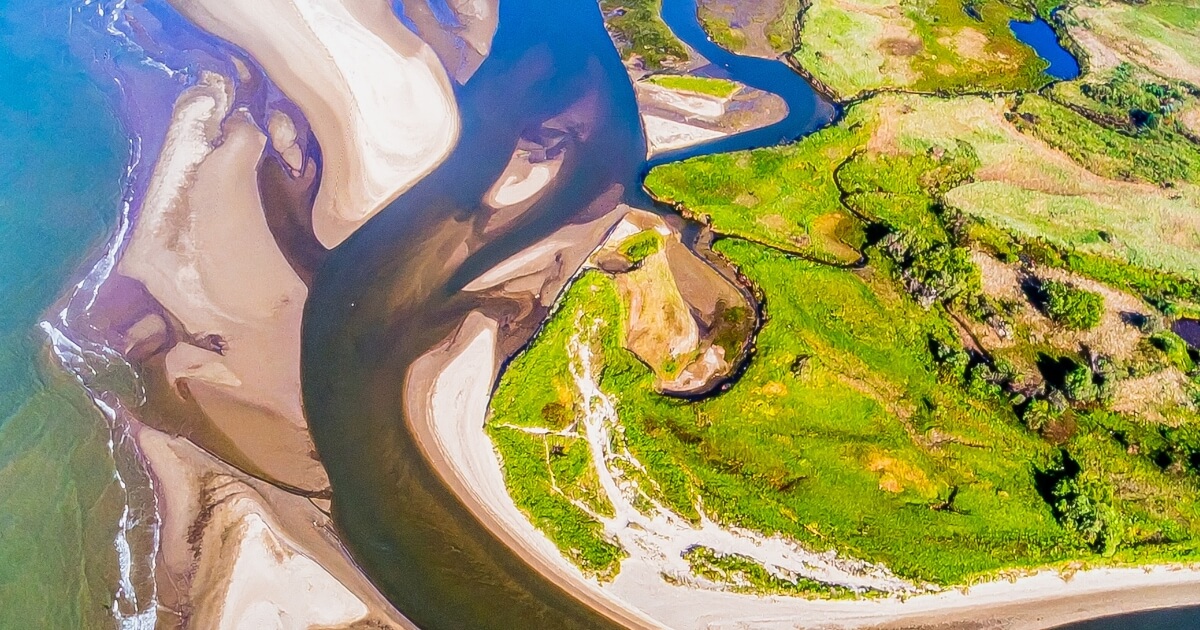
Both floodplains and deltas are found in the lower course of a river, both are formed by deposition, and both are flat, fertile areas of land. It is no surprise that students mix them up. But they are actually quite different landforms that form in different ways and in different locations along the river. This guide explains the difference between floodplain and delta clearly so you can tell them apart in any GCSE Geography exam question.
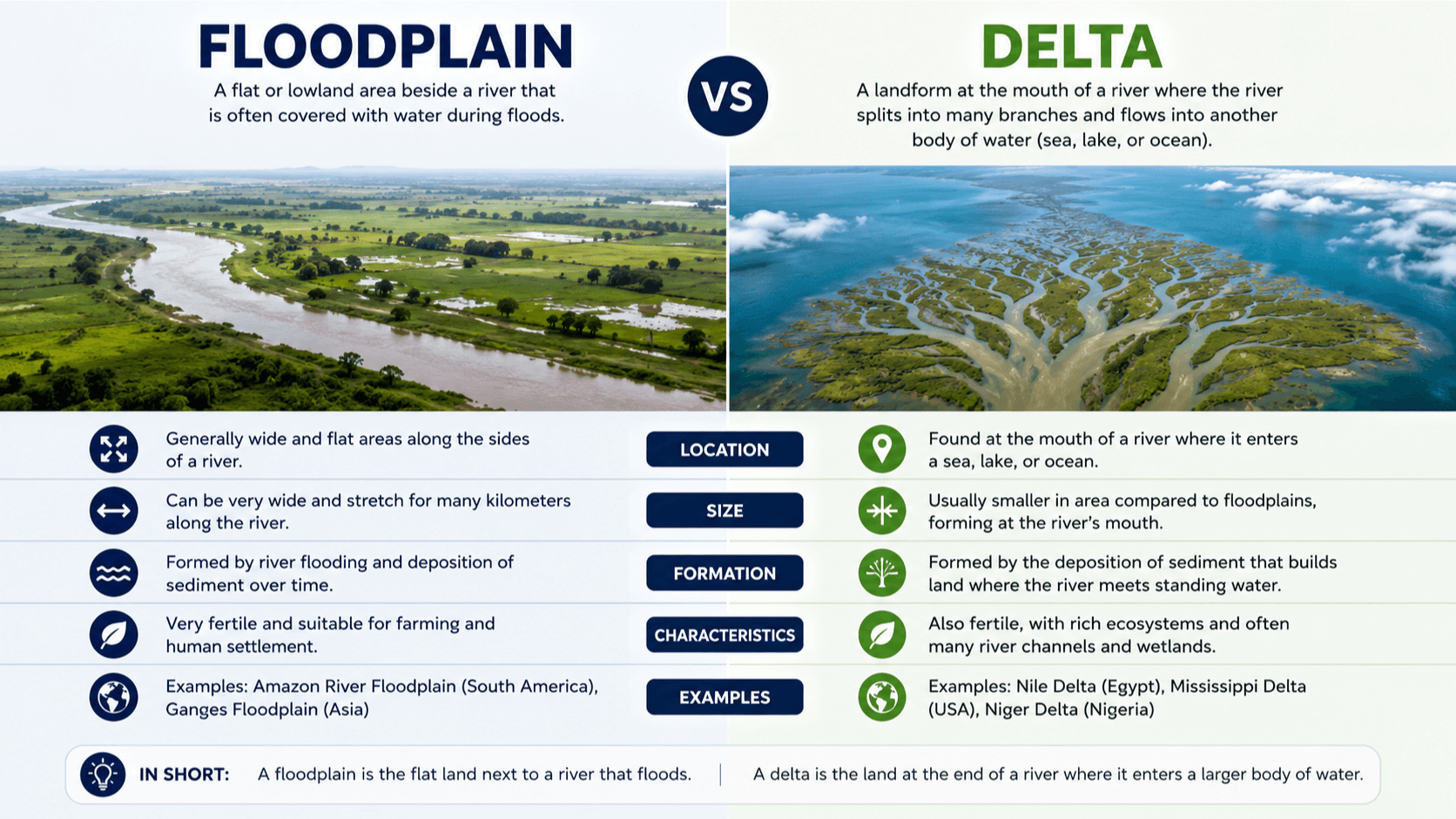
A floodplain is the flat area of land on either side of a river that gets covered with water and sediment when the river floods. A delta is a landform that builds up at the mouth of a river where it meets the sea or a lake, formed when the river deposits its sediment load as it loses energy. A floodplain runs alongside the river. A delta forms at the end of it.
Difference Between Floodplain and Delta: Comparison Table
| Feature | Floodplain | Delta |
|---|---|---|
| Definition | Flat land beside a river built up by repeated flooding | Landform built up where a river meets the sea or lake |
| Where it forms | Alongside the river in the middle and lower course | At the mouth of the river where it enters the sea |
| How it forms | Repeated flooding deposits sediment on the valley floor | River loses energy and deposits sediment at its mouth |
| Shape | Flat valley floor on both sides of the river | Triangular or fan shape extending into the sea |
| Relationship to river | River flows through the middle of it | River splits into distributaries across it |
| Soil fertility | Very fertile due to repeated sediment deposits | Very fertile due to rich river sediment |
| Examples | Thames floodplain, Ganges floodplain | Nile Delta, Mississippi Delta, Ganges Delta |
| Human use | Farming, settlements, industry | Farming, fishing, dense settlements |
What is a Floodplain?
To understand the difference between floodplain and delta, start with the floodplain. A floodplain is the wide, flat area of land that lies on either side of a river in its middle and lower course. It is formed over thousands of years by repeated flooding events that deposit layers of fertile sediment across the valley floor.
Here is how a floodplain forms step by step:
- In the middle and lower course, the river begins to meander across a wide valley
- During periods of heavy rainfall, the river receives more water than its channel can hold
- The river bursts its banks and floodwater spreads out across the surrounding land
- As the water spreads out it slows down and loses energy, depositing the sediment it was carrying
- The coarsest and heaviest sediment is deposited closest to the river, building up raised banks called levees
- Finer sediment is carried further across the floodplain before settling
- When the flood recedes, a thin layer of fertile alluvium is left behind
- Over thousands of years and thousands of floods, these layers build up to create the flat, fertile floodplain
Floodplains are some of the most agriculturally productive land on Earth precisely because of this repeated deposit of nutrient-rich sediment. The Nile floodplain has supported Egyptian agriculture for thousands of years. The Ganges floodplain feeds hundreds of millions of people across India and Bangladesh.
What is a Delta?
A delta is the other half of the difference between floodplain and delta. A delta is a landform that builds up at the mouth of a river, where the river meets the sea or a large lake. It forms when a river carrying a large load of sediment suddenly loses energy as it enters the relatively still water of the sea or lake, causing all that sediment to be deposited.
Here is how a delta forms step by step:
- A river carries large quantities of sediment in its lower course, eroded from further upstream
- As the river approaches the sea, its gradient becomes almost flat and it slows significantly
- When the river meets the sea, it loses its forward momentum almost entirely
- The river can no longer carry its sediment load and begins depositing it at the mouth
- Sediment builds up and the river is forced to split into smaller channels called distributaries to find a way to the sea
- These distributaries spread out in a fan or triangular shape, each depositing more sediment
- Over time the delta grows outward into the sea as more and more sediment accumulates
Not all rivers form deltas. For a delta to form, the river must carry enough sediment, the sea must be calm enough not to wash the sediment away, and the rate of deposition must be faster than the rate of erosion by the sea. The Nile, Mississippi, and Ganges-Brahmaputra are among the largest and most famous deltas in the world.
The Difference Between Floodplain and Delta in Location
One of the clearest ways to remember the difference between floodplain and delta is their location along the river. A floodplain is found running alongside the river through its middle and lower course. It is part of the river valley and the river flows through the centre of it. A delta is found only at the very end of the river, at the point where the river meets the sea or a lake. A river can have a long floodplain stretching for hundreds of kilometres but only one delta at its mouth.
The Difference Between Floodplain and Delta in Human Settlement
Both floodplains and deltas have attracted dense human settlement throughout history because of their fertile soils and access to water. However they present different opportunities and challenges.
Floodplains provide flat, fertile land ideal for farming. Many of the world’s great cities are built on floodplains, including London on the Thames floodplain. The risk of flooding is the main challenge, and cities invest heavily in flood defences such as the Thames Barrier to protect floodplain settlements.
Deltas also provide exceptionally fertile farmland and access to both river and sea for fishing and trade. The Nile Delta has been continuously farmed for over 5,000 years. However deltas face unique challenges including rising sea levels, which threaten to flood low-lying delta land, and the reduction of sediment supply caused by dams upstream, which means deltas are actually shrinking in some parts of the world.
Example 1 – The Thames Floodplain, UK (Floodplain):
The River Thames flows through a wide floodplain in its lower course. London itself is built on this floodplain. The flat, fertile land attracted settlement for thousands of years, but the risk of flooding has always been significant. The Thames Barrier, completed in 1982, was built specifically to protect London from tidal flooding. Without flood management, large parts of central London would be regularly inundated.
Example 2 – The Nile Delta, Egypt (Delta):
The Nile Delta is one of the oldest and most densely populated deltas in the world. Where the Nile meets the Mediterranean Sea in northern Egypt, thousands of years of sediment deposition have built up a triangular delta roughly 240 kilometres wide. Around 40 million people live on the Nile Delta today. The delta’s extraordinarily fertile soil has supported Egyptian civilisation since ancient times. However the Aswan High Dam, built in 1970, now traps much of the Nile’s sediment and the delta is slowly shrinking as a result.
Example 3 – The Mississippi Delta, USA (Delta):
The Mississippi River carries sediment from across the central United States and deposits it where it meets the Gulf of Mexico in Louisiana. The Mississippi Delta is a vast area of low-lying land, marshes, and distributary channels. New Orleans is built on this delta and sits partly below sea level, protected by an extensive levee system. Hurricane Katrina in 2005 demonstrated how vulnerable delta settlements are to flooding when those defences fail.
Example 4 – The Ganges Floodplain, India and Bangladesh (Floodplain):
The Ganges floodplain stretches across northern India and Bangladesh and is one of the most densely populated regions on Earth. The annual monsoon floods deposit rich sediment across the plain, making it extremely productive farmland. However the same floods that fertilise the soil also cause enormous destruction each year, displacing millions of people in Bangladesh alone. The floodplain illustrates both the benefit and the risk of living alongside a large river.
Floodplain = BESIDE the river. Delta = at the END.
Floodplain – think of a plain that floods. It sits BESIDE the river all along its course. The river flows through it and floods onto it during high water.
Delta – think of the Greek letter delta which looks like a triangle. A delta is TRIANGULAR in shape and forms at the END of the river where it meets the sea. Delta starts with D. So does Destination. The delta is the river’s final destination.
Quick test: if land is beside the river along its course, it is a floodplain. If land is built up at the river’s mouth in a fan shape, it is a delta.
Quick Quiz: Floodplain or Delta?
1. Flat land alongside a river that gets covered in water and sediment during floods. Is this a floodplain or a delta?
2. A triangular landform built up where the Nile meets the Mediterranean Sea. Is this a floodplain or a delta?
3. A river splits into distributaries as it approaches the sea, depositing sediment in a fan shape. What landform is forming?
4. London is built on flat, fertile land on either side of the River Thames. What type of landform is this?
5. Which landform is found at the mouth of a river where it meets the sea?
Difference Between Floodplain and Delta in Exams
The difference between floodplain and delta is tested regularly in GCSE Geography river landform questions. Exam questions may ask you to describe how each landform is formed, explain why each attracts human settlement, or compare the two. Always include the process of deposition in your answers, state clearly where each landform is found along the river, and use real world examples to support your points. Named examples like the Nile Delta and Thames floodplain will always strengthen your answer.
Common Mistakes to Avoid
Saying both form in the same location:
The most common mistake is treating floodplains and deltas as if they form in the same place. They do not. A floodplain forms alongside the river throughout its middle and lower course. A delta forms only at the river’s mouth. Always state the location clearly in exam answers.
Forgetting that deltas need specific conditions to form:
Not every river forms a delta. For a delta to develop, the river needs to carry enough sediment, the sea needs to be calm enough not to erode the sediment away, and deposition must outpace erosion. Rivers that enter high-energy seas with strong currents and waves often do not form deltas. Always explain the conditions needed, not just the process.
Confusing levees with floodplains:
Levees are raised embankments that form along the banks of a river as a result of flooding. They are part of the floodplain system but they are not the same as a floodplain. The floodplain is the entire flat valley floor. Levees are the raised ridges at its edges nearest the river channel.
Frequently Asked Questions
What is the main difference between floodplain and delta?
The main difference between floodplain and delta is location and formation. A floodplain forms alongside a river throughout its course when repeated flooding deposits sediment across the valley floor. A delta forms at the mouth of a river when the river meets the sea and deposits its entire sediment load in one place, building up new land that extends into the sea.
Can a river have both a floodplain and a delta?
Yes, and most large rivers do. The Nile, for example, has a long floodplain stretching through Sudan and Egypt along its course, and then a large delta where it meets the Mediterranean. The floodplain and delta are separate landforms that can coexist because they form in different parts of the river system.
Why are floodplains and deltas so densely populated?
Both floodplains and deltas are densely populated for the same basic reason: fertile soil and access to water. The sediment deposited by rivers is rich in nutrients, making floodplains and deltas some of the most productive farmland on Earth. Access to river water for irrigation adds to their agricultural value. However both also carry the risk of flooding, which is why managing water in these environments is so important.
What happens to a delta when a dam is built upstream?
When a dam is built upstream, it traps the sediment that would normally be carried down to the delta. Without new sediment being deposited, the sea begins to erode the delta faster than it can be replenished. The delta gradually shrinks. This is happening to the Nile Delta following the construction of the Aswan High Dam in 1970. Parts of the delta coastline are retreating by several metres per year as a result.
For more on river landforms, visit National Geographic: Delta.
Also read: Difference Between Erosion and Deposition and Difference Between Meanders and Oxbow Lakes to build your complete understanding of river geography.
Once you understand the difference between floodplain and delta, river landform questions in your GCSE Geography exam become much more straightforward to answer with confidence.
